geographies
![[]](https://www.unthinking.photography/media/pages/commissions/when-i-image-the-earth-i-imagine-another/2e5d370a6f-1675179032/noaa-18-s-49-w-2020-05-17-11-34-bst-hvc-horizontal-400x300-q85.jpg)
On the first day of the COP26 climate conference in Glasgow, a network of people operating DIY satellite ground stations around the world will capture a collective snapshot of the Earth.
TPG
2024-03
Rayane Jemaa's project investigating representation of the Middle East and North Africa (MENA) in a selection of video games, reconstructed using photogrammetry.

TPG
2020-04
The Earth Archive The Earth Archive is both a program of scanning focused on endangered landscapes and an open-source collection of LiDAR scans accessible to scientists around the world. Our …

the critical dictionary of southeast asia (cdosea), begins with a question: what constitutes the unity of southeast asia — a region never unified by language, religion or political power?cdosea …
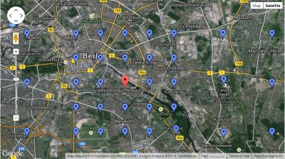
Simon Weckert - Google Maps Hacks Performance & Installation, 2020 “ 99 second hand smartphones are transported in a handcart to generate virtual traffic jam in Google Maps.Through this …
There is one other aspect to Prineville that made it an ideal location for Facebook’s facility. In 1911, when railroads were connecting the rural towns of central Oregon, Prineville seemed slated to …

"While the capacity to intervene in the production of urban space or formulate an effective vision of what’s to come has appeared increasingly cut off to the general population, long-term development projects and real-estate schemes continue to dictate city transformation well into the future. And we are increasingly inundated with the …

Merve Alanyali - Tracking Protests using geotagged Flickr photographs Watch: https://www.youtube.com/watch?time_continue=2&v=wCle_ARznj4 We analyse 25 million photos uploaded to Flickr in 2013 …
TPG
2017-07
Kaitlin Schaer, Drone Photogrammetry, 2017 Freestyle drone flying and racing is a growing sport and hobby. Combining aspects of more traditional RC aircraft hobbies, videography, DIY electronics and …

2017-05
When does the human need to leave the image? And what takes his/her place? How can one attempt to image a life severed by representation, and who has the ethical right to attempt such an aberrant, aniconic distortion?
TPG
2017-02
Picture Sky In this project we create a crowdsourced image of the sky. Multiple observers are positioned at GPS coordinates that form the points of a grid. At the moment of the satellite flyover, …

@lilianafarber‘s work questions the hierarchy of knowledge and the consumption of data. By exploring the complex relationships between pieces of information and their relation to personal and …

TPG
2016-11
A research project examining the infrastructure behind contemporary cartography

As our cities become smarter, the data of daily life is becoming increasingly granular. Sensors and cameras can tell us things like how many people cross a particular street during the morning …
TPG
2016-08
‘Where land meets sea’ The shoreline of Lesvos island, 3D Scanned with ScanLab @ UCL Lesvos is perhaps the largest ‘island’ on the archipelago of the 'migrant corridor’, along …